

Call 811 Before You Dig
Iredell Water Corporation is a member of North Carolina 811. Iredell Water only locates Corporation owned lines; private services to homes cannot be located by Iredell Water.
All locate requests can be made by dialing 811 from any phone. Please have the following information ready when you call 811. The call and locate are free and may save your life!
- Phone number
- Address (including the county)
- Is it inside or outside city limits?
- Is it in a subdivision?
- A cross-street name (nearest intersecting street & is it within a 1/4 mile)
- Where exactly is the area you wish to have located? (are you marking the area with white paint or flags)
- Work date, time, how long will the work take, what type of work is it and who is it for
After your call, you will be given a ticket number and a verbal list of utility companies that are notified by North Carolina 811. This does not mean each member listed owns buried utilities on your property. You will want to write down the names of the utility companies for easy reference. Every utility company is not a member of North Carolina 811.
WAIT THE REQUIRED TIME
North Carolina law requires a three working day notice to be given to the utility owners before your digging begins. Member facilities have three full working days, beginning the first working day after the notice is given, to mark the locate area requested for their underground utilities or notify the excavator of no conflict in that area.
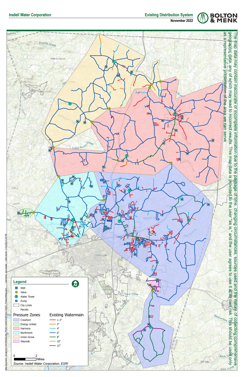
Service Areas & Map
Iredell Water's service area is located from north of Union Grove, to south and east of Statesvile to just east of Troutman. We serve areas of 11 of the 16 townships in Iredell County. A service area map can be seen below.
The map data may contain inaccurate or incomplete information due to the passage of time, changing circumstances, sources used and the nature of collecting comprehensive geographic data, any of which may lead to incorrect results. This map data below is provided to the user "as is," and the user agrees to use it at its own risk. This map should be used only as a representative presentation of the area we can serve and for informational purposes only.
 Distribution System